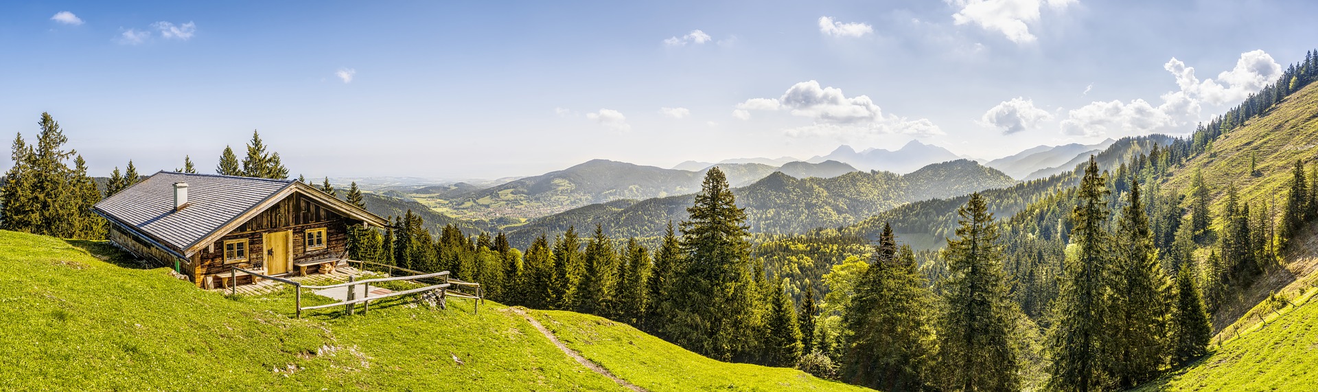
Take a hike!
Malerwinkel – Berchtesgadener National Park
Difficulty: Easy
Length: 3.2 km
Duration: 1hour 1minute
Elevation Gain: 160 m
Route Type: Loop
This enormously popular trail in the Berchtesgadener National Park leads to the eponymous Malerwinkel viewpoint, widely considered the most breathtaking of all scenic views overlooking Königssee. Along the way, you will pass the picturesque Königssee boat sheds and catch a view of the pilgrimage church of St. Bartholomä four kilometers in the distance. The Malerwinkel Cafe will invite you to linger a while over a drink and a snack before continuing on your way.
Eibsee Loop – Grainau
Difficulty: Easy
Length: 6.9 km
Duration: 1hour 56minutes
Elevation Gain: 215 m
Route Type: Loop
A hike along this beloved trail near the picturesque town of Garmisch-Partenkirchen is often referred to as “balm for the soul,” and the trail itself is considered one of the most beautiful hiking routes in Bavaria. The seven-kilometer loop abounds with breathtaking views, from the small islands in the northern part of the lake to the towering Zugspitze and the pristine, secluded Untersee. At the end of your hike, treat yourself to refreshments or a hearty meal at the lakeside Eibsee Pavilion.
Alpsee Loop – Schwangau
Difficulty: Easy
Length: 5.1 km
Duration: 1hour 23minutes
Elevation Gain: 139 m
Route Type: Loop
The easiest and most family-friendly route on this list is Schwangau’s idyllic Alpsee Loop. Take a dip in the crystal clear water, relax on one of the many lakeside benches, or train for your next 5K race while taking in views of high-rising mountains and two of Germany’s most famous castles—Neuschwanstein and Hohenschwangau.
Partnachklamm Weg – Garmisch-Partenkirchen
Difficulty: Easy to Moderate
Length: 7.1 km
Duration: 2hours 23minutes
Elevation Gain: 410 m
Route Type: Out & Back
The hike through the Partnach Gorge is one of the most beautiful in the Alps. Declared a natural monument in 1912, the rugged and romantic gorge fascinates visitors with its roaring waterfalls, white water rapids, tunnels and pools. Though moderately difficult, the hike is recommended for everyone, including families with children. The route’s numerous rest areas and huts provide hikers access to refreshment and recuperation along the way. Insider tip: the Partnachklamm Weg is especially spectacular in Winter, when the gorge becomes a wonderland of snow-frosted trees, frozen waterfalls and massive icicles.
Breitenstein via Kesselalm and Bucheralm – Miesbach
Difficulty: Moderate
Length: 8.4 km
Duration: 3hours 23minutes
Elevation Gain: 754 m
Route Type: Loop
This popular and multifaceted trail in the foothills of the Bavarian Alps provides a lovely mixture of breathtaking views and places to relax along the way. Should you require a little refreshment on your journey, food and drink can be enjoyed amidst stunning surroundings at the Berggasthof Kesselalm and Hubertushütte restaurants. Just past the Hubertushütte, the view from the summit of Breitenstein will astound you.
Höllentalanger Hut via Höllental – Grainau
Difficulty: Moderate
Length: 10.9 km
Duration: 3hours 54minutes
Elevation Gain: 738 m
Route Type: Out & Back
This route leads to the beloved Höllentalangerhütte and is a fantastic destination for mountain-loving families. Sure-footedness and a head for heights are a must on the route. The seasonally managed hut of the German Alpine Association is a good starting point for experienced mountaineers to scale the summit of the Zugspitze via the Höllental route.
Zugspitze via Höllental – Grainau
Difficulty: Hard
Length: 19.8 km
Duration: 9hours 10minutes
Elevation Gain: 2330 m
Route Type: Out & Back
This is where the Höllental route continues up from the Höllentalangerhütte to Germany’s highest mountain peak: the Zugspitze. The route offers everything adventurous hikers could wish for: a spectacular gorge, tunnels, mountain huts, slope valley, glacier and via ferrata with almost a kilometer of vertical exposure. For those not inclined to hike up the mountain on foot, a cable car can be taken up to the peak of the Zugspitze from the Eibsee.
On the Kramerspitz – Ammergebirge Nature Preserve
Difficulty: Hard
Length: 16.6 km
Duration: 6hours 14minutes
Elevation Gain: 1,275 m
Route Type: Loop
The Kramerspitz is located just north of Garmisch-Partenkirchen. This relatively demanding route up the mountain via the Kramerplateauweg and the Kramersteig rewards hikers with a fantastic view of the Bavarian Alps. The route can be hiked year-round and is especially popular in the Winter due to the particular challenges—and beauty—it presents in snowy conditions.
Herzogstand and Heimgarten – Kochel
Difficulty: Hard
Length: 16.3 km
Duration: 6hours 6minutes
Elevation Gain: 1,238 m
Route Type: Loop
This route is quite demanding, but very varied and a real classic. Hikers are rewarded with great views of the foothills of the Alps and its lakes as well as the Wetterstein Mountains and Zugspitze in the direction of the Alps. The starting point for this route is a parking lot; from there the path, which is marked with yellow signs, leads counter-clockwise toward the Herzogstand. The Herzogstandhaus is also a popular destination for non-hikers who use the cable car to get there. The Heimgartenhütte on the summit is a great place to rest, and if you want to jump into the Walchensee after your hike, you only have to cross the road once to get to the beach. It is advisable to take some warmer clothing with you in summer, as it can be cool in the higher elevations. Depending on the season, this hike is moderately to heavily visited.
Zum Schrecksee – Allgäu High Alps Nature Preserve
Difficulty: Hard
Length: 16.4 km
Duration: 6hours 0minutes
Elevation Gain: 1,177 m
Route Type: Out & Back
This delightful hike through the Allgäu High Alps nature reserve is rife with picturesque landscapes and views. The highlight is of course the idyllic Schrecksee, which probably got its name because of its ice-cold water. The path to the Schrecksee is not the most demanding tour in the Allgäu, but a moderate level of fitness is required for the 16 kilometers. Even in alpine terrain, you will climb almost 1,200 meters along this route. At higher altitudes, snow should be expected until early summer. The route starts near Bad Hindelang at the parking lot “Auf der Höh” at the southern exit of Hinterstein.